Flood Risk Analysis
Why assess flood risk for your project?
The record of flood events registered between 1950 and 2017 indicates that most floods have occurred in recent decades. About 2% of floods occurred during the 1950s, this has since increased rapidly every decade thereafter to about 3.9%, 6.6%, 13.2%, 21.9%, and 52.2% for the sixties, seventies, eighties, nineties, and the millennium, respectively, showing a growing trend in flood-related disasters world-wide.
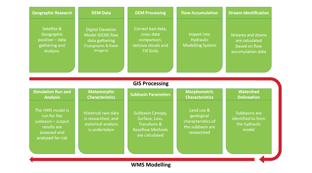
The flood risk analysis is a comprehensive technical study to measure the effective impact of high risk of floods to reveal any potential risk to your project. Analyses are based on the combination of Geographic Information System (GIS), and Watershed Modelling Systems (WMS), using state of the art software packages and high-quality datasets.
The approach can be defined as a staged process in a logical order. Initial high level geographic research is undertaken to ascertain a firm foundation on the subject location, environment, and position prior to in-depth research. Analysis of satellite data, weather station records, soil data, physical characteristics and land use are all researched and imported into the software suite, to provide an accurate and comprehensive assessment.

Flood risk analysis report
